You are using an out of date browser. It may not display this or other websites correctly.
You should upgrade or use an alternative browser.
You should upgrade or use an alternative browser.
Question about google maps..
- Thread starter KenM
- Start date
The friendliest place on the web for anyone who enjoys boating.
If you have answers, please help by responding to the unanswered posts.
If you have answers, please help by responding to the unanswered posts.
Active Captain has several views that you can select from: nautical, which is Garmin's raster charting, sonar which has more bottom detail, road which is like Google Maps, and satellite which is like Google Earth.
David
David
Tamrow
Veteran Member
- Joined
- Jan 17, 2016
- Messages
- 95
- Location
- USA
- Vessel Name
- Chesapeake
- Vessel Make
- Mainship 30 Pilot II
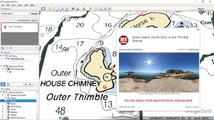
Yes, you can open NOAA raster charts as a layer in Google Earth and it’s easy. Here is the link to download the chart kmz file to open in Google Earth...
https://seamlessrnc.nauticalcharts.noaa.gov/arcgis/rest/services/RNC/NOAA_RNC/ImageServer
Click on the View In: Google Earth link at the top of the page to download the chart kmz file. Open Google Earth and then navigate to where you saved the kmz file and drag and drop the kmz file you downloaded onto the earth. The Charts will open as a layer in Google Earth. The chart layer will include all the current NOAA charts throughout the United States.
caltexflanc
Guru
You can also view and download the current USACE hydrographic surveys of various inlets,harbors, channels (such as ICW) in kmz form. Often more current than the latest NOAA chart edition.
- Joined
- Jan 9, 2014
- Messages
- 4,181
- Location
- USA
- Vessel Name
- N/A
- Vessel Make
- 1999 Mainship 350 Trawler
The reason I like Active Captain over Google Maps is it has views that include NOAA charts and markers (apparently Google has a plugin for that), along with boating resources (Fuel, marinas, anchorages, etc).
Tamrow
Veteran Member
- Joined
- Jan 17, 2016
- Messages
- 95
- Location
- USA
- Vessel Name
- Chesapeake
- Vessel Make
- Mainship 30 Pilot II
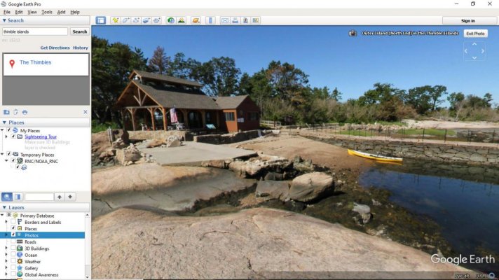
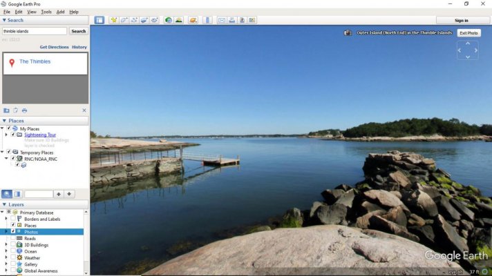
Each application has its strengths and it makes sense to use the tools you feel are relevant for you. Google Earth, beyond the chart overlay also has an enormous geo-referenced photo library layer which can help the user visualize a location beyond the chart content. The example I have included is a panoramic image I took and uploaded to the website 360cities.com of Outer Island in the Thimble Islands, they share their panoramic images to Google Earth. When you click on the photo icon on the chart, the image is represented in a pop-up, and when you click on the image in the pop-up the panorama opens. The panoramic image can be navigated to display a 360 degree view of the location.
Here is a link to the panorama in 360cities.com...
https://www.360cities.net/image/outer-island-north-end-in-the-thimble-islands
Here is a link to the panorama in 360cities.com...
https://www.360cities.net/image/outer-island-north-end-in-the-thimble-islands
Attachments
Last edited:
Similar threads
- Replies
- 3
- Views
- 478


