High Wire
Guru
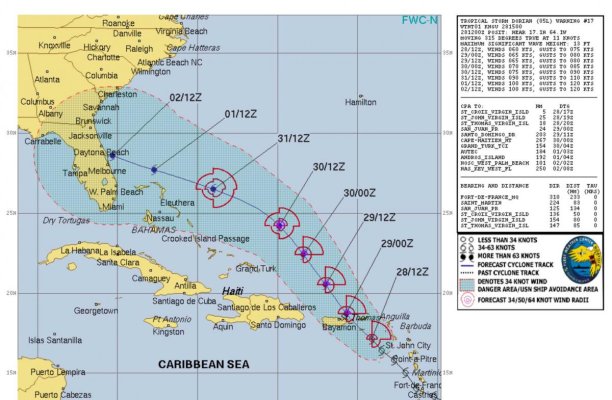
It’s a weak one but will do some damage.

https://www.nhc.noaa.gov/storm_grap...ind+png/114855_5day_cone_no_line_and_wind.png
https://www.nhc.noaa.gov/storm_grap...ind+png/114855_5day_cone_no_line_and_wind.png
Last edited:

If your going to haulout, better get on the list now. In situations like this, the haulout list goes from empty to "sorry we're full" in a matter of hours.My boat is in the Abacos-- Black Sound on GTC. ��*
Trying to decide if it can ride out winds from 40-70mph in the slip. It's tied off with 6 lines and I can possibly get a local to add 4 more. Jib is off. No canvass up but I kind of worry about my big solar panels and the storm surge raising me up too much.
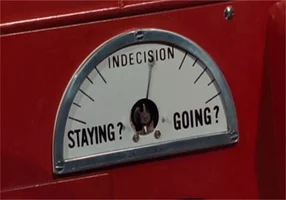
The hurricane plan is to run it across the sound to the yard to haul it out and strap it down. Trying to decide.
If your going to haulout, better get on the list now. In situations like this, the haulout list goes from empty to "sorry we're full" in a matter of hours.
Ted
")
Just remember the margin of error on predicted center-of-cone track has been 200 miles in recent years.
It's like predicting a sports event. The predictions become 100% accurate only after the game is over.
The margin of error does reduce the closer the time gets on hurricanes but right now we're still 4 to 5 days from landfall.
It's like predicting a sports event. The predictions become 100% accurate only after the game is over.
The margin of error does reduce the closer the time gets on hurricanes but right now we're still 4 to 5 days from landfall.
In horse racing, it aint over until any and all protests are resolved

Greetings,
Mr. c. Save the "pity party" for after the fact. Might turn into a "whoopee party". We're potentially in the path, as well. Can't run so double and triple the lines and cash in some Karma points.It ain't over until...well, you know the rest.